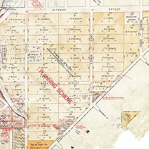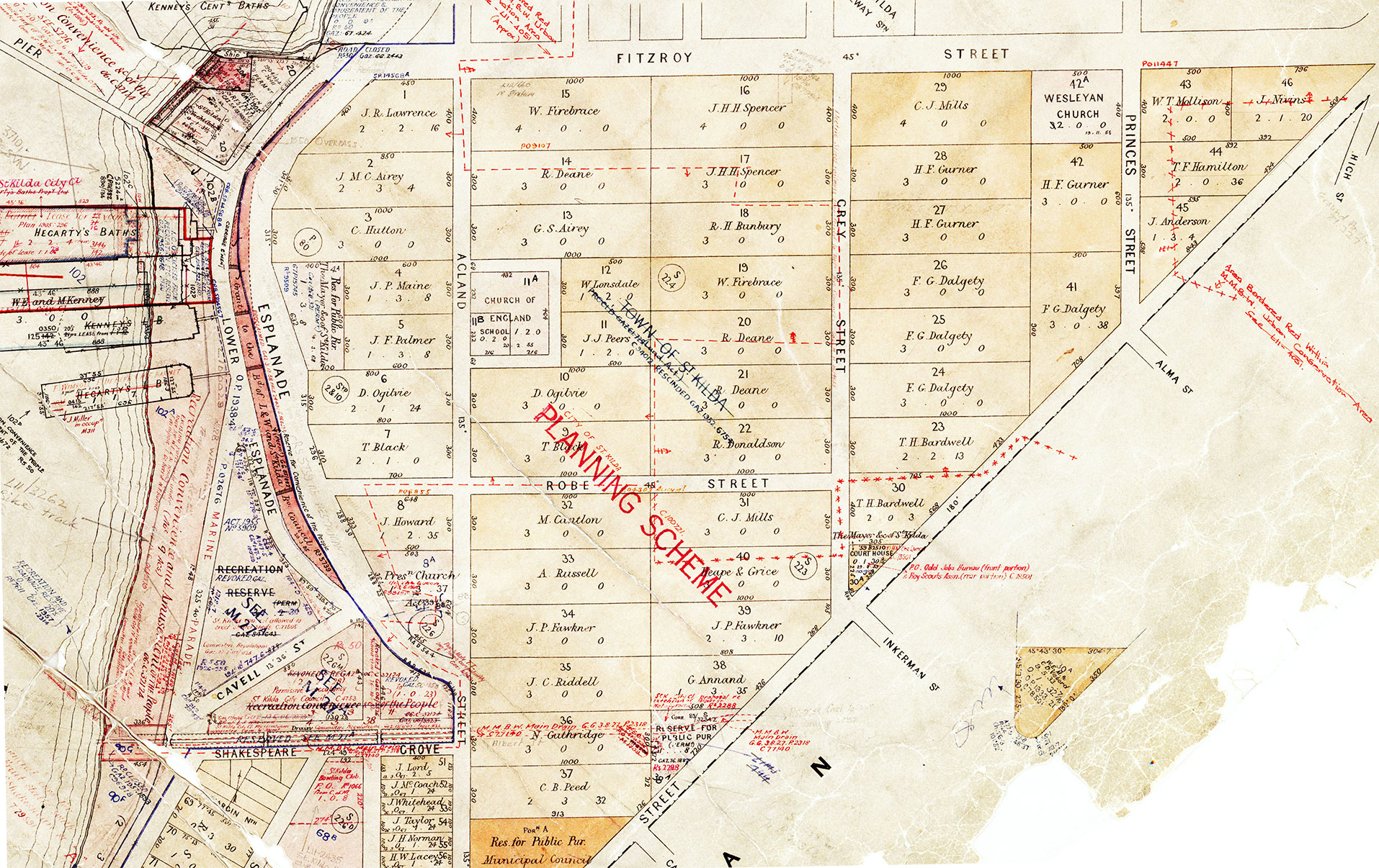
1857. St Kilda Town planning map: Revised as being the St Kilda City planning map showing the early allotments in the St Kilda Hill area. As well as allottments there are early changes to use makred in red.. Since it is part of a larger map we plan to ensure the full map is digitized and accessibble to clearly identiy the first owners of Crown Allotments in the St Kilda area.
1857 Crown Allotments St Kilda Planning Scheme (part) M27(333)